


- Geophysical Survey for
Oil & Gas Exploration 〉 - Seismic Survey & Seismic
Monitoring for
Civil Engineering 〉 - Technology Innovation in
Engineering Geophysics 〉 - Development of
Geophysical Instruments 〉 - Meeting the Clients' Needs 〉
- Geological Evaluation for
Oil & Gas Development 〉 - Remote Sensing &
Geoinformatics 〉
- Geophysical Survey for


Remote Sensing & Geoinformatics
~Data Processing &
Analysis Compiled According to Client Needs~
JGI’s remote sensing and geoinformatics provide high quality technical services and solutions for integrating image processing, analysis & interpretation, structural & petroleum geology, tectonics, geomorphology, in conjunction with GIS technology. Our service covers not only the various stages of hydrocarbon exploration but also solutions for environmental issues in both offshore and onshore areas.
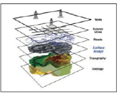
Concept of GIS database |
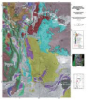
Geological interpretation map |
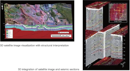
Data integration and visualization techniques provide important tools for a better understanding of the relationship between surface and subsurface structures, from outcrop scale to synoptic regional scale. Digital Elevation Model (DEM) derived from earth observation satellites provides 3D representations of the Earth’s surface, which may be combined with other surface and subsurface information, such as geological mapping results and interpreted seismic sections.
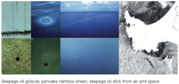
JGI has established its own proprietary technique for oil seepage slick mapping which provides key information for offshore hydrocarbon exploration. JGI also offers marine environmental monitoring services based upon earth observation satellite data.
Copyright (c)JGI, Inc. All Rights Reserved.