Comprehensive Geological Consulting Service
Table of Contents
Geological Analysis Service
JGI integrates various geological, geochemical and geophysical data to analyze and evaluate subsurface geology, and constructs geological models that visualize the distribution, structure, and properties of strata in 3D. Each geological model is constructed as a heterogeneous model by adopting an optimal grid system according to the target strata and depth sections to be analyzed, while considering the quantity and quality of the available data.
![[Modeling heterogeneous subsurface structures]](https://jgi-inc.com/en/wp-content/themes/originaltheme/asset/img/technology/other-services/analytics01.png)
Geological analysis
Various surveys are conducted to understand the subsurface structures.
◇Literature review and Information collection
For the target area, various types of geological information are collected and investigated from multiple perspectives, such as the characteristics of geological structures and their development history.
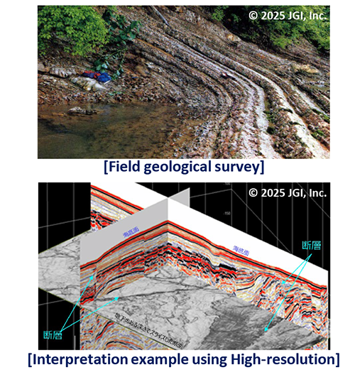
◇Surface geological survey
Field surveys are conducted in the target area and surrounding regions to collect geological information, including the types of strata.
◇Geological structure analysis
Using 2D and 3D seismic survey data, subsurface geological structures-including the shape, dip, continuity, overlap of strata, as well as the presence, type, trend, and length of faults-are analyzed. A 3D geological framework (structural) model, consisting of fault planes and geological boundaries is then constructed.
Geological model construction
Various analyses are conducted to estimate oil and gas reserves, evaluate CO₂ storage capacity, and to preparate base model for flow simulation.
◇Well data analysis
Well core analysis data and well logging data are analyzed to evaluate the physical properties of strata near the wells, including sand/mud identification, porosity, and water saturation.
◇Lithofacies model
Based on well data and seismic reflection patterns, sedimentary environment at the time of formation (depositional model) is estimated. Sedimentary facies analysis is then applied to evaluate horizontal and vertical lithofacies variations and continuity in each stratum.
◇Rock physical property model
By analyzing seismic attributes such as the amplitude and phase of reflected waves (attribute analysis), the physical properties and heterogeneity of strata can be estimated. As the basis for flow simulation, rock physical property model is built by applying physical information, such as porosity and permeability obtained from well data analysis and seismic attribute analysis, to lithofacies model.
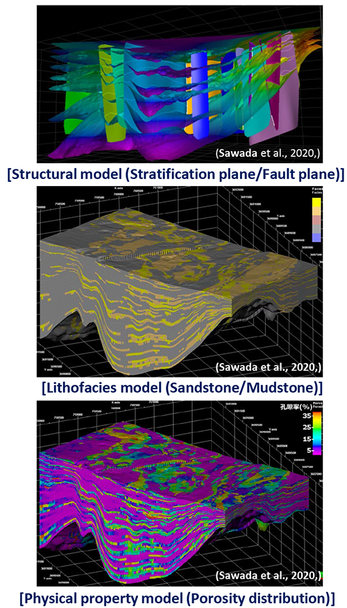
(Sawada et al., 2020, The 3rd Technical Seminar of the 3D Geological Technical Analysis Consortium )
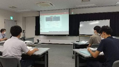
Training Service
Our company offers a wide range of training programs based on our extensive experience. These programs are designed to support professional development across various fields in geology, geophysics, and petroleum engineering.
▶Basic Course on Geological Analysis and Geophysical Survey Techniques (for Entry-Level Employees)
▶Basic Course on General Geology
▶Geophysical Data Processing and Practical Training Course
▶Training Programs for Overseas Engineers
Basic Course on Geological Analysis and Geophysical Survey Techniques
Target Audience:
·Entry-level employees in geology and geophysics, or reservoir engineering
·Junior engineers with up to about three years of experience
Course Content:
·Specialized lectures and exercises on geological and geophysical surveys
·Field trips to geological sites (Niigata, Akita, etc.)
·Visits to JAPEX Technical Research Institute and JGI Ranzan Research Center
·Oil exploration evaluation exercises
(Please ccontact us for more details)
Duration:
·Approximately 3 months (annually from early June to mid-September)
Format:
·Participants can take all subjects or select specific ones
Location:
·JGI conference room or nearby rental conference rooms
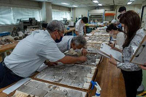
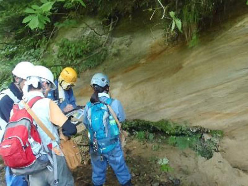
Basic Course on General Geology
Target Audience:
·Engineers in geology and geophysics, and reservoir engineers
·Technical professionals working with subsurface strata
*This course is also valuable for those seeking practical insights for using subsurface information derived from the geological outcrops.
Course Content:
·Lectures and field observation of outcrops
·Clear guidance on core samples, well logs, seismic sections, and stratigraphic modeling
·Focus on foundational knowledge and practical sense
Duration:
·Lectures: 2 half-days
·Field trip: 1~2 days (overnight or day trip)
Format:
·Field trips are optional
Location:
·Lectures: JGI conference room, nearby conference room, or online
·Field trips: Niigata Prefecture
Geophysical Data Processing and Practical Training Course
Target Audience:
·Personnel handling seismic data processing
·Those responsible for quality control in outsourced data processing
·Anyone wishing to acquire fundamental skills in data processing
Course Content:
·Short lectures on each step of data processing, covering theory and parameter settings
·Hands-on exercises with real data
·Practical training using interactive data processing software
Duration:
·Approximately 1 week
Location:
·JGI conference room
Training Programs for Overseas Engineers
Target Audience:
·Engineers from overseas clients in geology, geophysics, and petroleum engineering
Course Content:
·Lectures and workshops on geology and geophysics (G&G)
·Geological field trips
·Facility visits
Duration:
·1~2 weeks
Location:
·Lectures: JGI conference room
·Field trips: Niigata Prefecture

* Please contact us for course fees and other inquiries