Latest Technical Service

High-Precision Geophysical Data Processing and
Analysis Services
Latest Technical Service
High-Precision Geophysical Data Processing and
Analysis Services
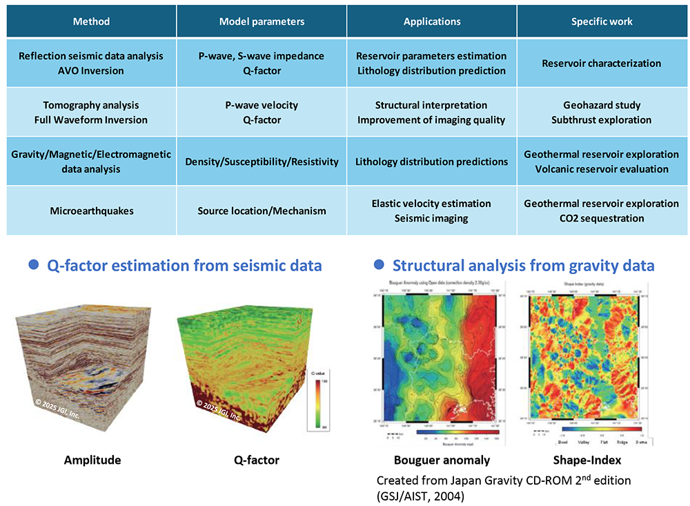
For better imaging of subsurface structures, advanced data processing technology is required to reduce noises and enhance weak signals from underground in the field record. We provide two- and three-dimensional data processing services for land, marine, and transition environments, utilizing the state-of-the-art data processing technology. We also offer physical properties estimation through quantitative interpretation (QI) techniques such as seismic inversion and AVO analysis, which support for predicting properties of the rock composing the geological layer and types of the fluid saturated in the pore space of the rock.
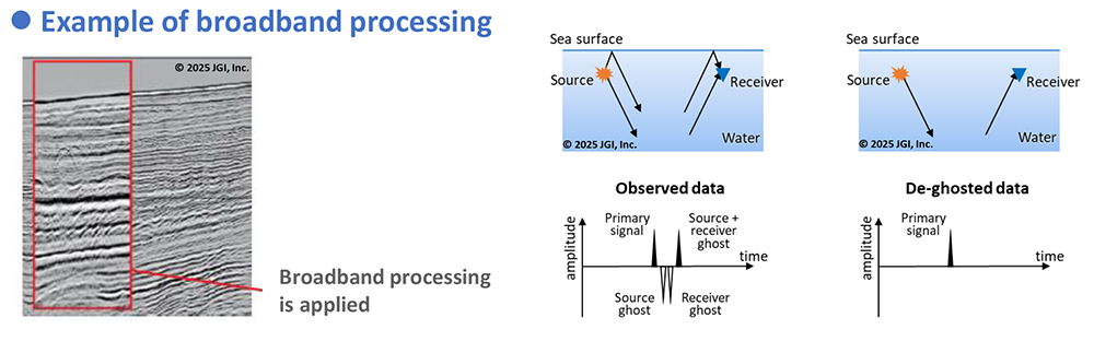
▶Broadband processing (advanced wavelet processing)
We provide an advanced waveform processing package comprising airgun bubble suppression, ghost reflection suppression, and Q-effect compensation to make the seismic wavelet “broadband” for improved accuracy in geological interpretations and physical property evaluations.
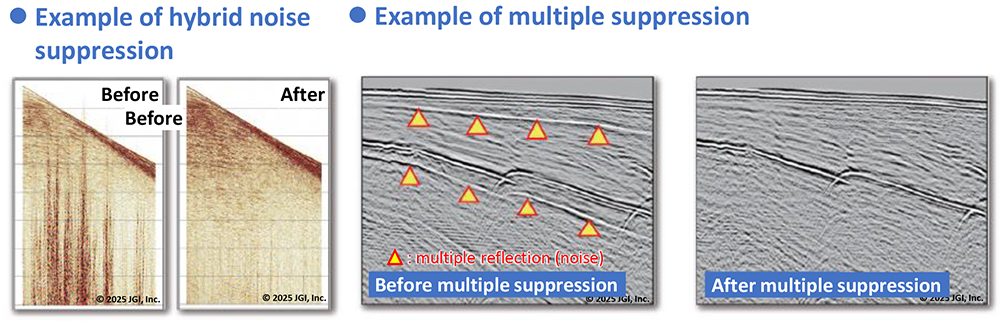
▶Hybrid noise suppression processing in multidimensional regions
Seismic data are rearranged into various order such as on shot-, receiver-, or offset-basis and mathematically transformed into various domains including frequency or Radon domains, to better separate noises from signals. For multiple reflections, one of the most severe noises in the marine survey, we apply combinations of various suppression methods based on different principles to support various types of multiple reflections.
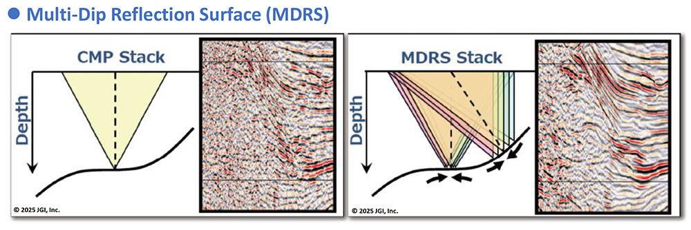
▶Pre-stack Imaging Processing
In severe noise environments, we have propriety technique called Multi-Dip Reflection Surface (MDRS) method, an extension of Common Reflection Surface (CRS) method. Through high-definition imaging processing that combines MDRS method with various seismic migration processes, we can extract weak reflection waves and visualize the underground more clearly. Moreover, the advanced version of MDRS, called “pre-stack MDRS” offers improved accuracy of velocity estimation and physical property analysis through clearer gather data with low noise level.
▶Physical property analysis/applied analysis
We estimate physical properties and lithology of geological formations through analysis of various geophysical survey data, including reflection seismic data. The information obtained from the analyses can be used for various purposes, including evaluation of reservoir properties.