Contribution to Earthquake Preparedness and Subsurface Utilization
Table of Contents
Academic/Disaster Prevention
In order to elucidate the mechanism of occurrence of earthquakes and volcanic disasters, it is important to understand the physical properties and structural forms of the subsurface in detail. Since the 1995 Hyogo Prefecture Nanbu Earthquake, many underground and geological surveys have been conducted by the government and university research institutions who proactively use seismic surveys, and it is used as a basic information for considering and planning disaster prevention counterplan and mitigation measures.
In active fault study, the possibility of future earthquakes and the magnitude of such earthquakes are predicted based on the results of surveys such as the location, length, displacement, and activity history of active faults. On the other hand, it is also necessary to “know the ground” and “understand the epicenter of an earthquake” to predict shaking during an earthquake. For the ground that affects the amplification of earthquake motion, the seismic wave velocity structure from the shallow engineering basement (sediment with an S wave velocity of about 0.3 to 0.4 km/s) to the earthquake basement (rock with an S wave velocity of about 3 km/s or more, although it is deep in the sedimentary plain) is important. Geophysical exploration methods such as reflection seismic exploration, refraction seismic exploration, VSP method using wells, and microtremor array observation are used. In addition, in order to understand the epicenter image of earthquakes, it is necessary to grasp the ultra-deep earthquake source fault such as the subduction surface of the plate, and it is important to integrate deep-scale seismic exploration and earthquake observation data. Geophysical exploration technologies related to active faults and earthquake source faults play an important role in the site safety assessment of nuclear power plants.
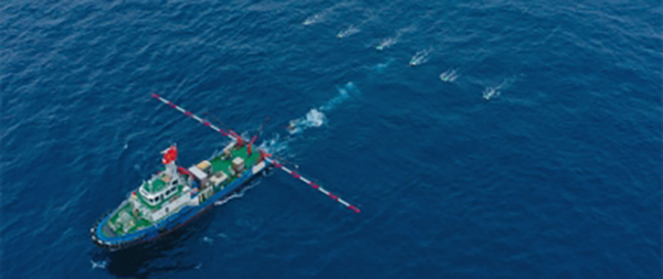
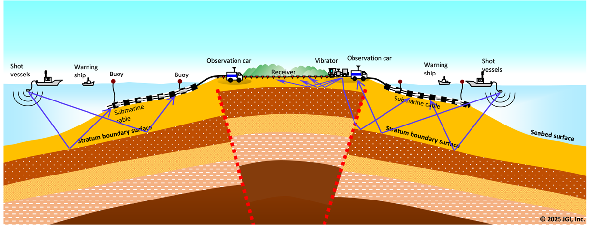
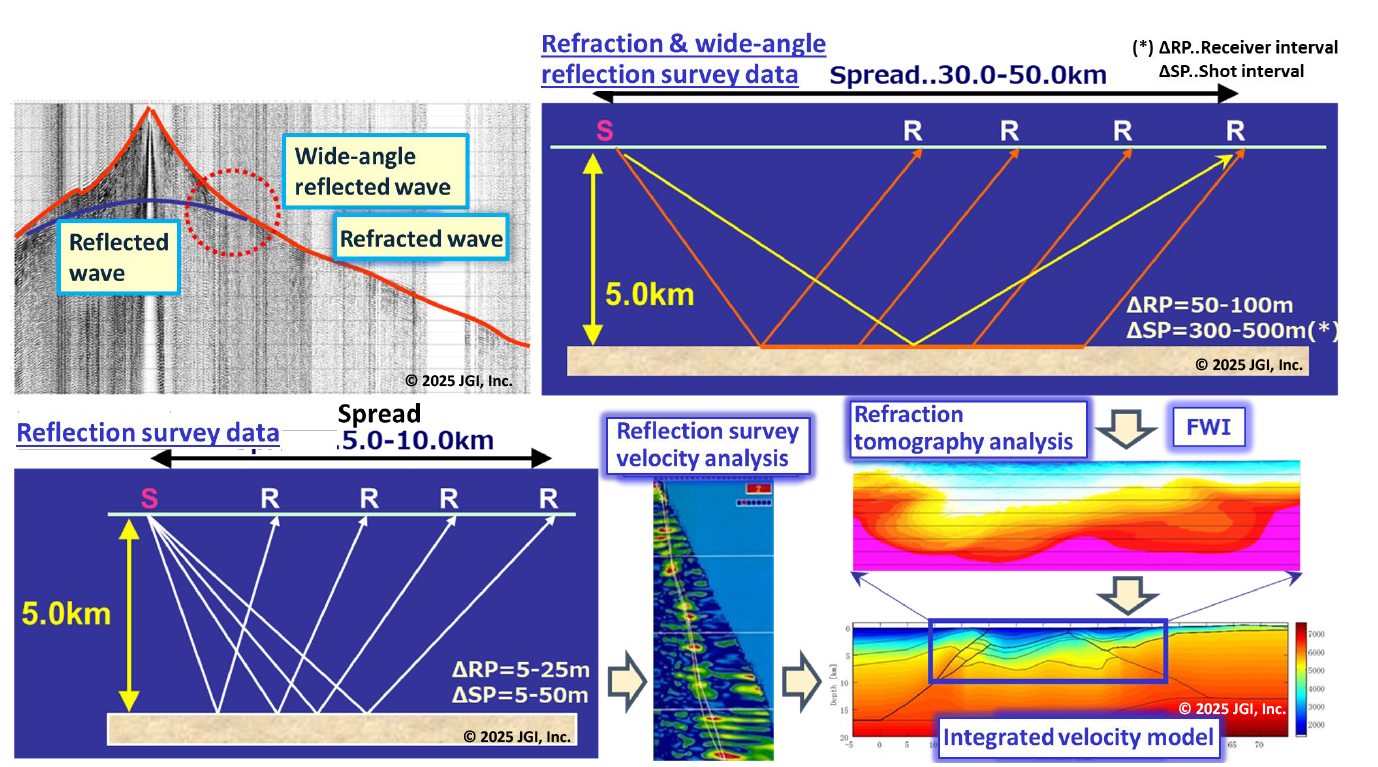
We have a wide variety of seismic survey systems to cope with difficult terrain and geological conditions, and we can conduct multi-scale surveys according to various survey scales, from shallow surface surveys to deep crustal structure surveys for seismogenic layers with a depth of 20 to 30 km. In particular, by combining seismic sources used in land and sea areas with a receiver system, it is possible to conduct sea-land seamless crustal structure surveys in coastal areas, and has many achievements in geological surveys related to site safety of nuclear power plants.
S-wave information
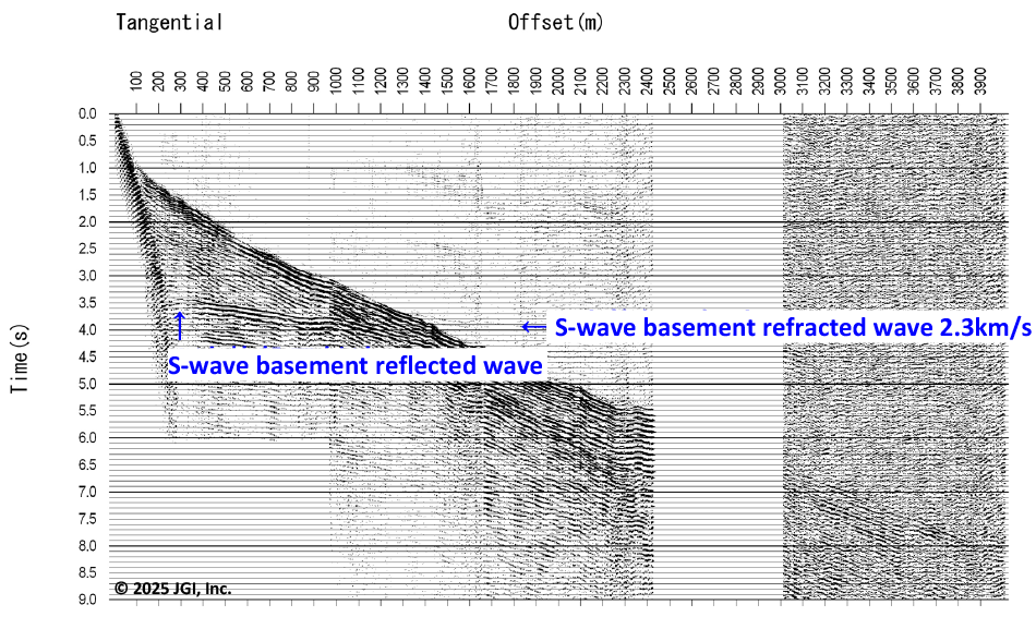
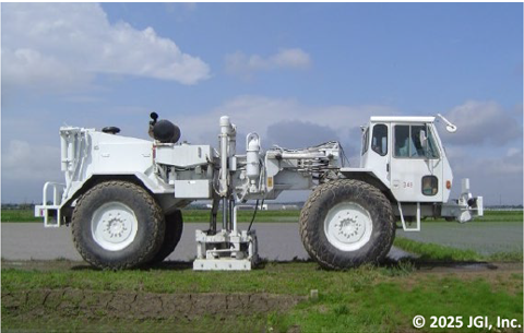
For geotechnical investigations related to seismic engineering and civil engineering, the S-wave velocity is important subsurface information. We propose a high-resolution survey from the engineering basement to the seismic basement using an S-wave impactor for the shallow layer and an S-wave vibrator for the medium-to-deep depth of about 1 km.
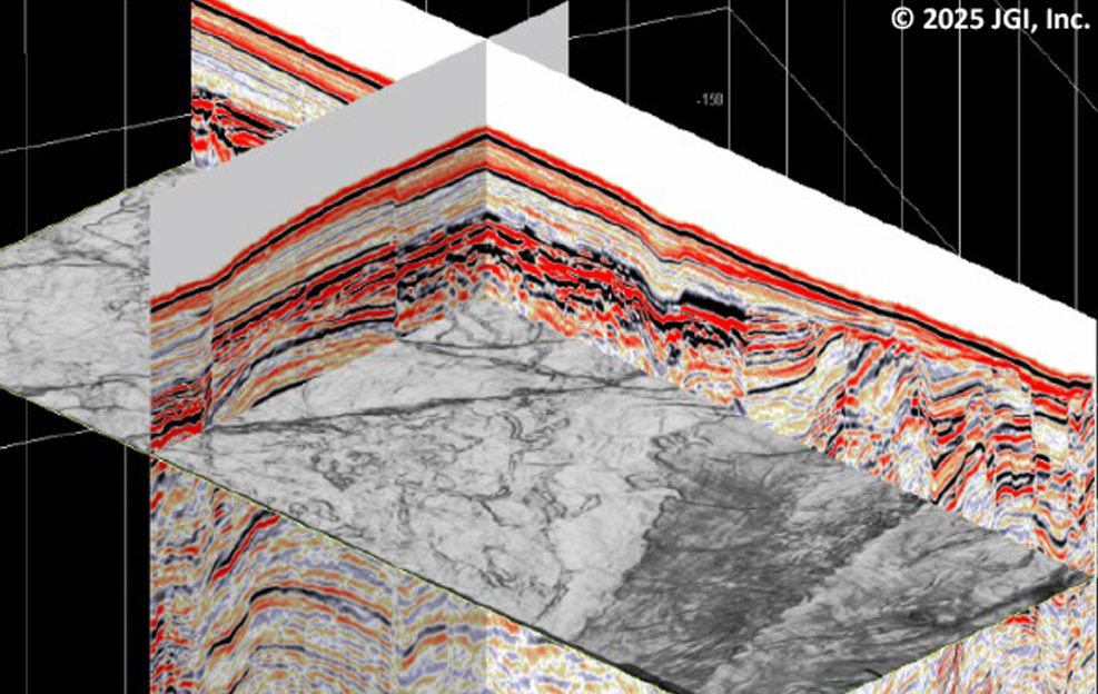
High-precision velocity estimation -Multi-scale exploration-
By combining a conventional telemetry system with an autonomous data recording system with Wi-Fi transmission, we provide multi-scale exploration services from shallow to deep by long-range receiver spread. In this multi-scale exploration, the simultaneous acquisition of refractive waves, reflected waves, and wide-angle reflected waves enables advanced velocity estimation and high-precision velocity model construction by combined processing using refractive tomography analysis, full waveform inversion, and pre-stack migration.
Civil Engineering and Infrastructure Maintenance Management
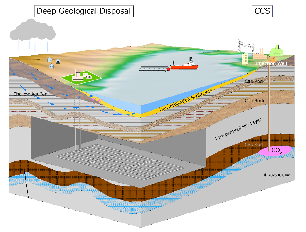
Civil engineering and infrastructure maintenance is one of the important issues in highly seismicity country Japan to support Japan’s economic development. We provide useful information from the viewpoint of avoiding geological risks such as active faults, soft ground, and shallow gas, with the aim of contributing to the civil engineering field related to the design and construction of structural foundations and the maintenance and management of aging infrastructure, as well as the environmental field such as geological disposal of radioactive waste and underground space utilization.
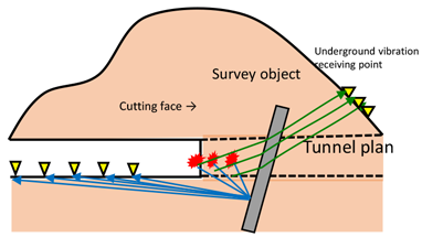
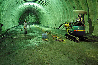
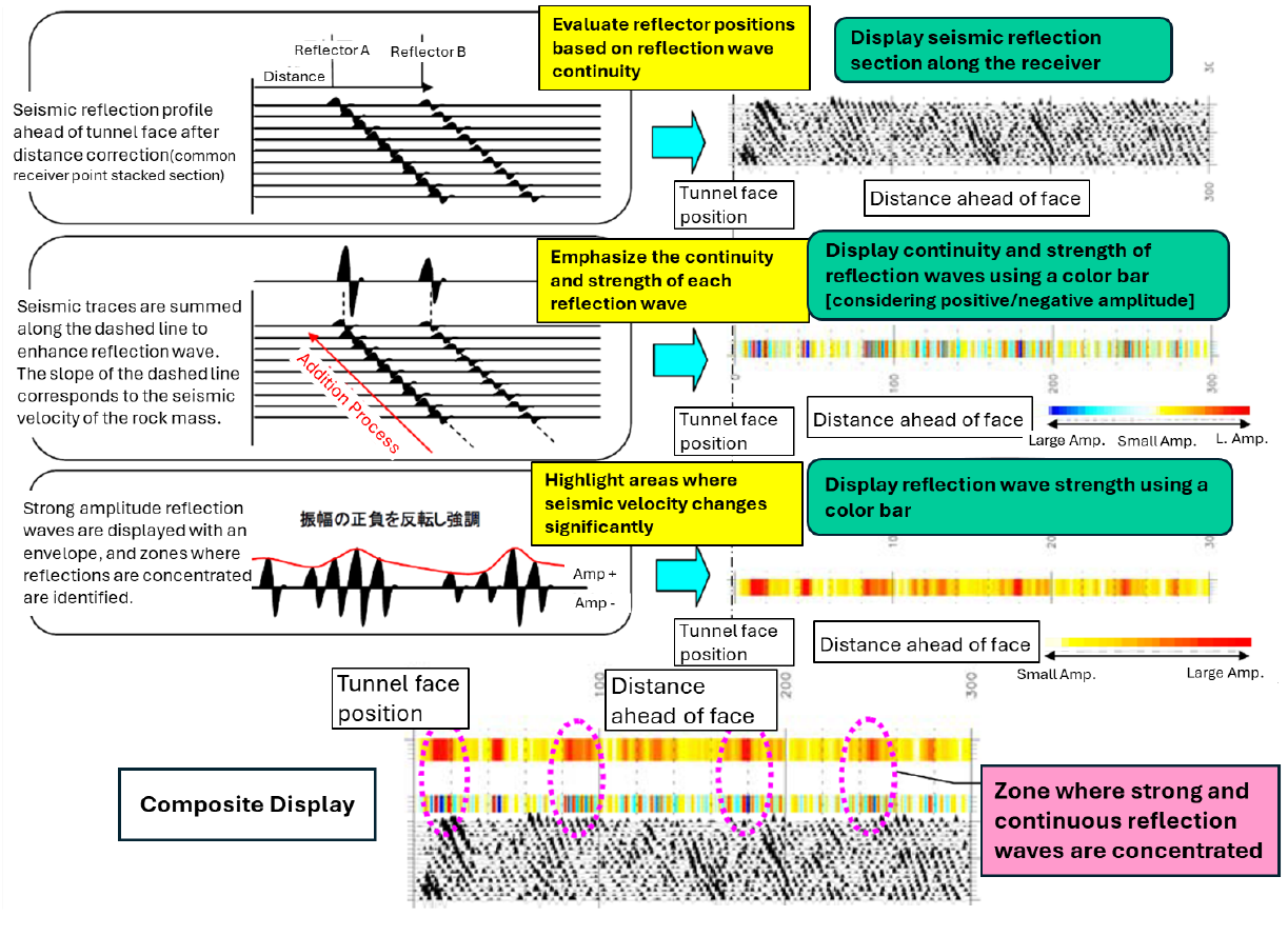
Tunnel shallow reflection method
We are developing a tunnel face forward exploration method in collaboration with Fujita Co., Ltd. The SSRT (Shallow Seismic Reflection Survey for Tunnels), which uses drilling blasting or mechanical sources such as hydraulic impactors to predict dangerous points in front of the tunnel face, has been put into practical use, and Geosys Co., Ltd., our partner company, is conducting site work, data processing, and analysis.
(Modified from the materials provided by Fujita Co., Ltd.)
Provided by Fujita Co., Ltd.
Provided by Fujita Co., Ltd. (joint research result with the company)
Detection of Displacement for Infrastructures and Ground Surface Using Satellite Data
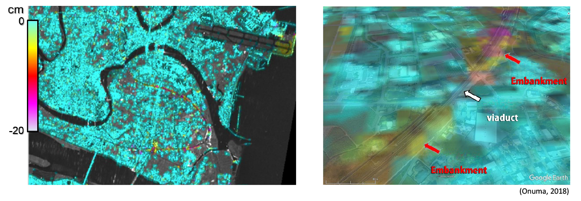
JGI provides a range of services for civil engineering and infrastructure maintenance utilizing InSAR (Interferometric Synthetic Aperture Radar) analysis. Our services include risk assessment related to surface displacement in fault zones, ground subsidence and sinkholes, as well as time-series analysis of displacement in artificial structures such as dam embankments and roads.
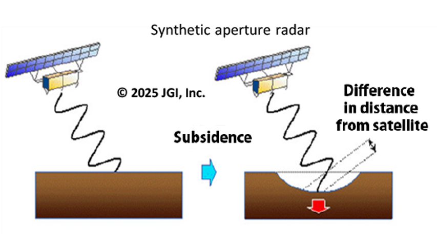
A satellite SAR emits microwaves toward the Earth‘s surface and receives the scattered waves from the surface. These scattered waves can be used to image the geometry and properties of terrain and structures. SAR data also contains information on the distance between the satellite and the Earth’s surface, and by calculating the difference in distance from observed data of two different times, it is possible to detect surface displacement that occurred between two observation dates.

Geospace Utilization and Environmental Conservation
JGI conducts high-resolution geophysical surveys and analyses of geological structures, rock/formation properties, faults/fracture zones and groundwater systems by combining a variety of geophysical exploration techniques. For groundwater systems, we conduct analyses to assess groundwater reserves from shallow to deep layers, as well as their conservation and management, and to predict the flow of contaminated water and contaminants.
By integrating geophysical, geological, geotechnical and hydraulic data, we build high-resolution 3D geological models and offer comprehensive consulting services of geological risk assessments for the safe use of underground spaces including geological disposal, and for environmental conservation projects.