Contribution to the Stable Supply of Natural Resources
and Energy
Table of Contents
Hydrocarbon Exploration
We provide geophysical services to explore hydrocarbons buried deep underground. For the successful resource exploration and development, it is necessary to understand the geological structure and desirable reservoir properties that are likely to be concentrated in hydrocarbons. The reflection seismic survey provided by JGI, Inc. is an essential and standard technology for evaluating the physical properties of reservoirs as well as visualizing detailed subsurface structures in three dimensions.
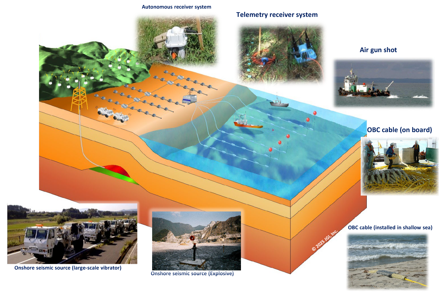
We combine a variety of seismic sources and receiver systems in land, shallow waters, and marine areas in a flexible manner to collect optimal 2D and 3D reflection seismic data according to the type of hydrocarbon and depth of exploration
●Land area: Through the combination of autonomous and wired telemetry systems and the optimized source energy, seismic data are recorded with flexible receiver layouts (more than thousands of points are available) that accommodate irregular topography, near-surface variation, and restricted surface conditions.
●Shallow waters: We have the greatest advantage in shallow waters, where we connect the data with the sea bottom receivers and land geophones, shot by various airgun sources and land sources and provide seamless 3D data from land to shallow waters.
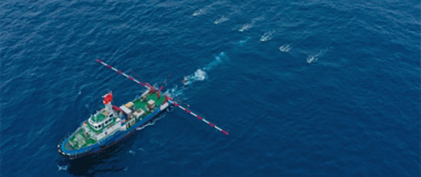
●Marine area: We provide small- to medium-scale 3D exploration services suitable for coastal areas using multipurpose vessels temporarily equipped with airgans and streamers, as well as large-scale 3D exploration services with dedicated mid-class seismic vessels.
To evaluate oil and gas potential, it is essential to perform an integrated analysis of the petroleum system, which consists of the elements of source rock, reservoir rock, carrier bed, and seal, as well as the processes of trap formation, petroleum generation, migration, accumulation, and preservation. Basin modeling, a part of petroleum system analysis, allows us to reconstruct the geohistory and to simulate the geological, geochemical, and hydrodynamic evolution of the petroleum system elements and processes within a sedimentary basin, thereby evaluating the oil and gas exploration potential.
JGI provides advanced petroleum system analysis by integrating various geological and geophysical data with well data, interpreting geological structures, constructing three-dimensional geological models, and performing basin modeling. We also provides consulting services related to oil and gas exploration potential, evaluating geological risks and reserves based on the results of petroleum system analysis.
Exploration of Mineral Resources in Deep Sea
– Methane Hydrate and Rare Metals –
Japan’s exclusive economic zone(EEZ) contains a rich of energy sources, metal, and mineral resources. These include methane hydrate, also known as ‘burning ice’, formed by the crystallization of methane and water, the main components of natural gas. Other resources include seafloor hydrothermal massive sulfide (SMS) deposits, cobalt-rich crusts, manganese nodules that are rich in useful metals, and rare-earth mud.
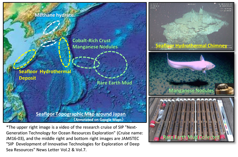
These marine resources are expected to serve as a vital alternative source of metals and minerals to support Japan’s economy and industries. They are considered essential for securing a stable supply of rare earth elements(REEs), which significantly affect industrial competitiveness, and for achieving a carbon-neutral society by 2050.
JGI possesses advanced technologies, including 2D/3D high-resolution seismic survey and marine electromagnetic surveys. By integrating these capabilities, we deliver comprehensive survey services for resource estimation and environmental impact assessment in marine development projects.
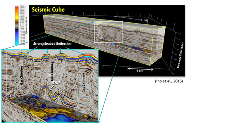
The figure above shows a gas chimney existing in a methane hydrate deposit area in the Sea of Japan, as revealed by 3D high-resolution seismic survey.
(SIP “Next Generation Marine Resource Research Technology” Debriefing Session, 2018)
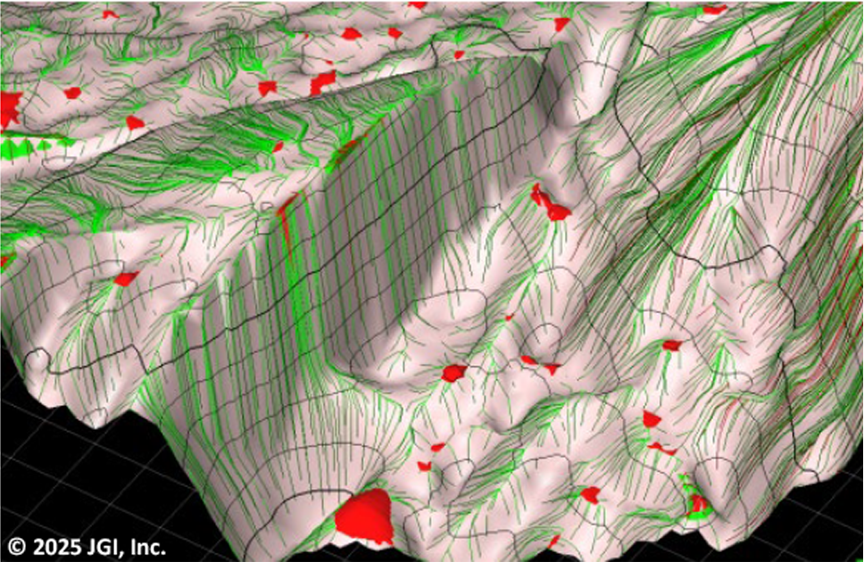
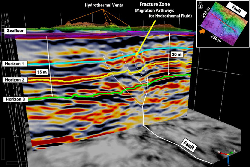
The figure on the right presents the results of 3D seismic survey conducted in a seafloor hydrothermal deposit area, estimating the subsurface faults and fractures acting as pathways for hydrothermal fluids.