Technical Information
Preliminary Results of Surface Displacement caused by the Sanriku Offshore Earthquake
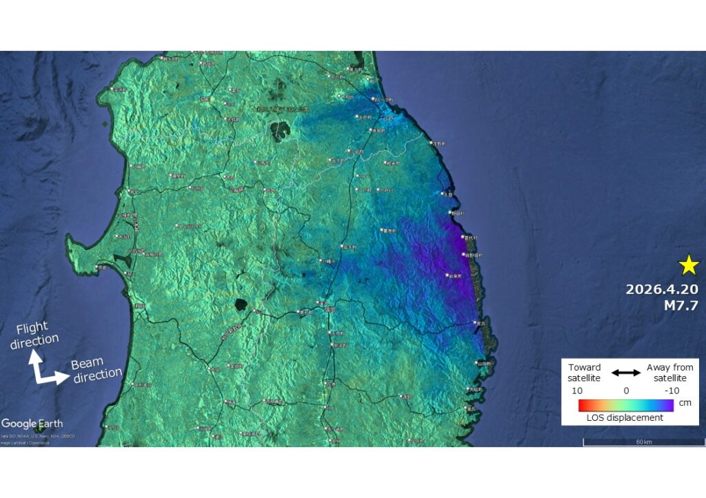
The figure shows the distribution of co-seismic surface displacement caused by the 2026 Sanriku-Oki Earthquake (April 20, 2026, 16:52 JST; M7.7), derived from the differential interferometric SAR (DInSAR) analysis using Sentinel-1 C-band SAR data, acquired on April 9 and April 21, 2026. The yellow star in the figure indicates the location of epicenter, as announced by the JMA. The displacement amount is of along the Line of Sight (LOS) direction of SAR illumination. Negative values indicate the displacement away from the satellite, corresponding to subsidence, eastward displacement, or both. A maximum surface displacement of approximately 9 cm away from the satellite was observed, primarily along the Pacific coast of Iwate Prefecture. The distribution pattern of the displacements is concordant with the map derived from GEONET data (https://www.gsi.go.jp/chibankansi/chikakukansi_20260420_sanrikuoki.html). Please note that the figure is preliminary, and no corrections have been applied for the atmospheric delay and other effects.