



Technical Information
Preliminary Results of Surface Displacement caused by the 2026 Kumamoto Earthquake
Differential interferometric SAR (DInSAR) analysis was performed using Sentinel-1 SAR data acquired before and after the 2026 Kumamoto Earthquake (Mj7.1; Mw6.8), which occurred at 7:27 UTC on July 28, 2026. The results revealed surface displacement extending approximately 45 km along the Hinagu fault zone. In addition, surface displacement was detected up to 10–15 km away from the fault trace.
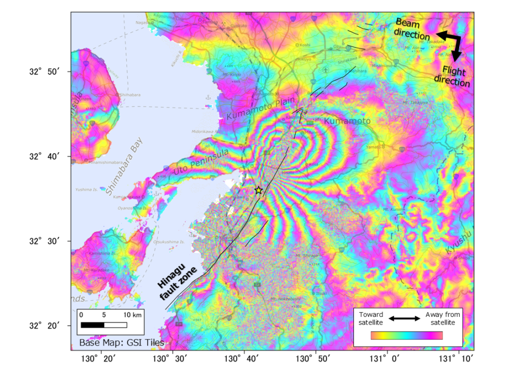
Fig.1 Differential Interferogram
(The yellow star indicates the location of epicenter, as announced by the JMA. The black lines indicate the active faults traced from the 1:200,000 Geological Map ‘Kumamoto’ and ‘Yatsushiro and Part of Nomozaki’ published by the AIST.)
Sentinel-1 data acquired from a descending orbit at around 21:16 UTC on July 16 and July 28, 2026, were used for DInSAR processing. Figure 1 shows the differential interferogram. Sentinel-1 SAR data are C-band (wavelength = 5.6 cm), where one cycle of phase change corresponds to surface displacement of half a wavelength (2.8 cm) in the satellite’s line-of-sight direction. A decrease in phase indicates a decrease in distance, which corresponds to movement toward the satellite.
Please note that these figures are preliminary, and no corrections have been applied for the atmospheric delay and other effects.