Offshore/Shallow-Water Seismic Survey System
▶Offshore Seismic Survey System
・Maneuverable 3D Seismic Survey System
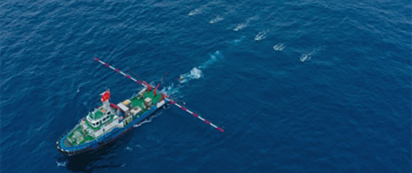
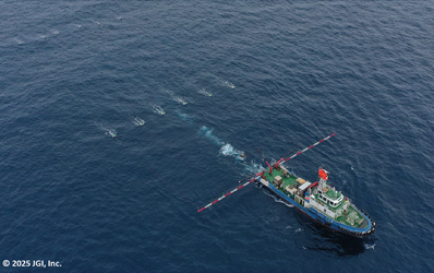
Marine seismic surveys are widely applied not only to the exploration of oil and natural gas resources, but also to the exploration of methane hydrates and seabed mineral deposits, etc. In recent years, they have also been used for CCS(Carbon Capture and Storage) site selection and characterization as well as for seabed geotechnical investigations related to offshore wind farm development. JGI has introduced the SERCEL Seal 428 system for large-scale surveys and has developed in-house UHRS (Ultra High Resolution Seismic) systems for shallow, high-resolution surveys. Using these systems, JGI provides a wide range of two-dimensional(2D) and three-dimensional(3D) marine seismic survey services. The SERCEL Seal 428 system is used for 2D and 3D surveys targeting mid to deep-depth zones greater than 1 km. Data are acquired using a vessel commonly available for charter, with a gross tonnage of about 2,000 tons, which tows streamer cables up to 5,000 meters long along with seismic air gun sources. The system is highly maneuverable, enabling surveys to be conducted in shallow coastal areas with depths of around 30 meters and extending to offshore areas. Due to the presence of reefs, shallow waters, and offshore artificial structures, long streamer cables cannot be towed in some offshore areas. In such cases, our proprietary dual-vessel acquisition technique—which deploys medium to small-sized vessels, with source vessels equipped with large seismic air guns and streamer vessels equipped with short streamer cables—enables long-offset surveys to be conducted in a flexible and safe manner.
Technical Specifications
・ SERCEL Seal428 Brochure
・ SERCEL Seal428 Specifications
・UHRS High-Resolution Marine 3D Seismic Survey System
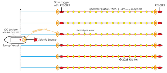
The UHRS system was developed for high-resolution seismic surveys targeting shallow to mid-subsurface layers. It is used for methane hydrate resource assessment, CCS storage site selection and characterization, seabed investigations for offshore wind farm development, site surveys for marine construction, and related applications. Data acquisition is conducted using a small survey vessel with a gross tonnage of about 200 to 300 tons, towing streamer cables about 100 meters long with hydrophones embedded and seismic sources such as small seismic air guns, boomers, and sparkers. It is possible to carry out 2D/3D surveys from shallow coastal areas with water depths less than 10 meters to further offshore area.
Related Pages
・Seismic Survey Data Processing and Analysis Services
・Seamless Onshore-Offshore Multi-Scale Exploration Service
▶Shallow-Water Seismic Survey System
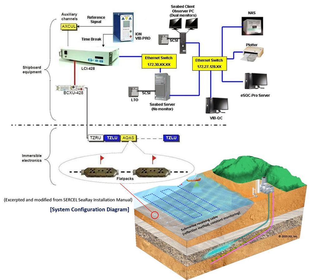
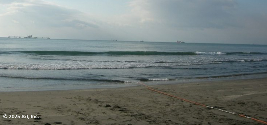
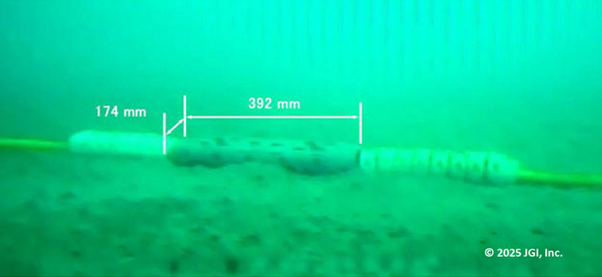
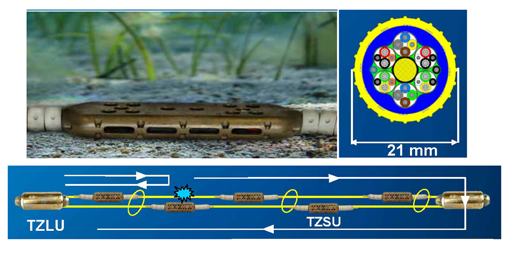
SeaRay is a relatively shallow-water OBC (Ocean Bottom Cable) system manufactured by Sercel in France, and it can be operated in water depth of up to 100 meters. The sensor unit consists of four components: 3C MEMS accelerometers combined with a hydrophone. These components are embedded in an enclosure made of aluminum bronze. This system features a heavy, flat-shaped enclosure that allows for stable deployment even on sloped seafloors. In addition, the 3C-MEMS sensors can measure the tilt of the installation surface, enabling the three-component MEMS data to be output as if the sensor were placed on a horizontal plane. As a result, no gimbal mechanism – commonly required for conventional sensors – is necessary. Underwater cables are lighter and easier to handle on board than other OBC cables armored with steel wire. All components of the central recording unit installed on board are networked, enabling monitoring and control from a client PC. Furthermore, simultaneously acquiring signals from the hydrophone and the accelerometer enables the suppression of receiver ghost occurring between the seafloor and the water surface (dual-sensor technique). JGI owns a SeaRay system with a total length of approximately 10 kilometers with sensors embedded every 25 meters. The system is capable of using both offshore and onshore impulse sources by default. In addition, we have developed QC software to support seismic vibrator sources as well, enabling seamless transition zone surveys extending from land to offshore areas using various types of sources.
Technical specifications
・ SERCEL SeaRay 428
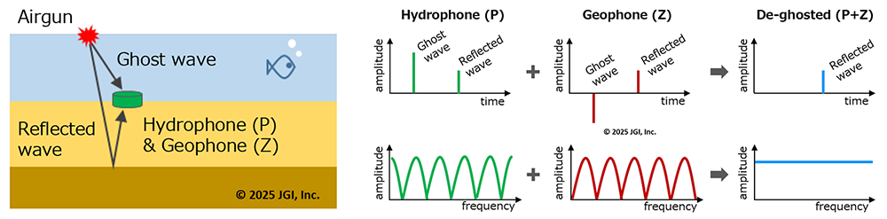
Data acquired by hydrophones and accelerometers exhibit the same polarity for reflected waves, but opposite polarity for ghost waves. By leveraging this characteristic, ghost waves can be suppressed and data containing only reflected waves can be generated through appropriate summation of the two different datasets.
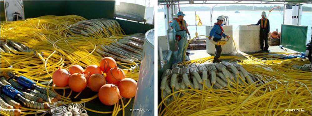
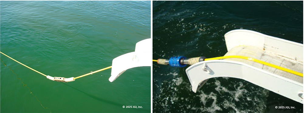
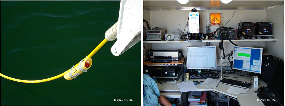
・Photos of Onboard Operations (OBC deployment)
(Excerpted and modified from SeaRay brochure by SERCEL)