Latest Technical Service
Remote Sensing Technology Service
Latest Technical Service
Remote Sensing Technology Service
By applying advanced remote sensing techniques (Satellite data analysis methods), JGI provides a wide range of analysis services in the field of oil and gas, geothermal energy, CCS, academic research, disaster prevention, environmental management, and civil engineering. At every stage of a project, we provide valuable information and support comprehensive risk assessments.
What is Remote Sensing?
Remote sensing is a technology of observing and measuring the Earth’s surface, oceans, forests, and atmosphere from a distance-without direct contact.
Satellites, aircraft, and drones equipped with cameras and sensors capture reflected light, thermal radiation, or microwaves to generate data. This data is then analyzed to create maps, monitor environmental changes, and assess disaster impacts.
Key advantages of Satellite Remote Sensing:
・Wide area observation in a single pass
・Regular and continuous monitoring
・Data acquisition in hard-to-access areas
・Access to archived data
・Cost efficiency
These capabilities make it possible to monitor deforestation, flooding, and other large-scale environmental changes over time.
Sensors are classified into two types:
・Passive sensors: Detect natural electromagnetic waves such as sunlight.
・Active sensors: Emit radar or laser signals and receive their reflections or scatterings. They do not rely on sunlight and can observe even at night.
Remote sensing is widely applied in agriculture, forestry, fisheries, urban planning, disaster prevention, environmental protection, and natural resource exploration. In recent years, integration with AI and big data has enabled more sophisticated analysis, predictive modeling, and decision-making.
Application of Remote Sensing in Hydrocarbon Exploration and Development
Remote sensing is widely applied across all stages of oil and gas exploration and development.
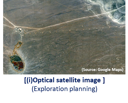
1.Preliminary Surveys
(i) Planning
Optical satellite data are used for the following purposes;
・Designing seismic survey lines
・Selecting exploratory well locations
・Planning facilities and infrastructures
(ii) Screening
Optical and radar satellite data are used to screen target areas:
・Optical satellite data : to identify prospective areas for oil exploration.
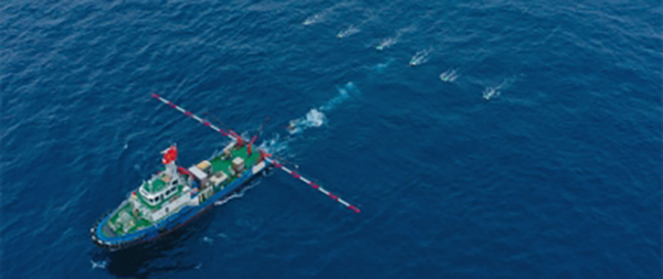
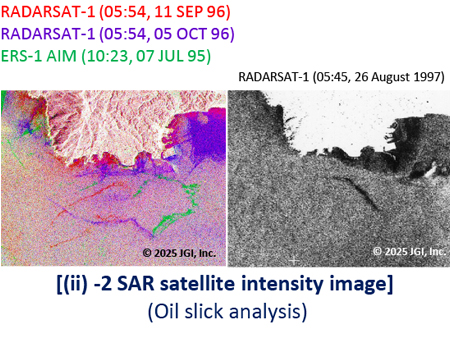
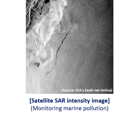
・Synthetic Aperture Radar (SAR) satellite data : to extract oil seepage for offshore exploration.
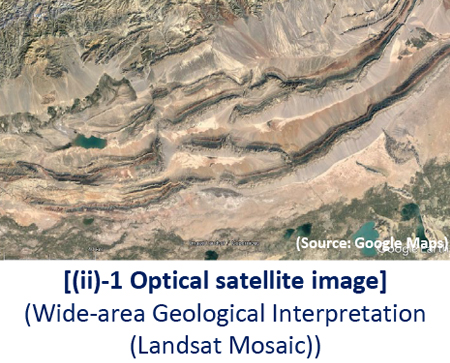
2. Exploration
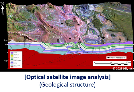
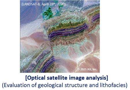
Optical satellite data are effective for supporting geological structure and petroleum system analysis to evaluate topography, geological structure and lithology.
3.Development & Production
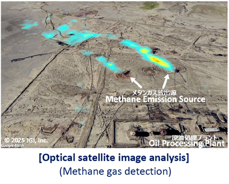
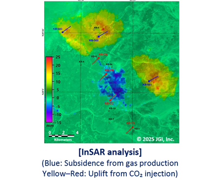
Optical satellite data are used to detect gas leaks from facilities and to monitor atmospheric gas concentrations. In addition, SAR satellite data are used to monitor marine pollution and for interferometric SAR (InSAR) analysis to monitor surface deformation, such as land subsidence, associated with oil and gas production.
Our Satellite Data Analysis Services
Optical sensor (multispectral/hyperspectral) data processing and analysis
We provide surface observations, geological structure analysis, detection of oil seep, and monitoring of methane and CO₂.
Synthetic Aperture Radar (SAR) data processing and analysis
We offer the following services;
・ Offshore oil seep detection using oil slick mapping analysis,
・ Displacement detection and monitoring of the ground surface and artificial structures using differential interferometric SAR (InSAR) analysis.
Case studies:
- – 2021 Haiti Earthquake
- – 2020 Oaxaca Earthquake, Southeastern Mexico2019 California Earthquakes
- – 2019 Ridgecrest, California, Earthquakes
- – 2019 Yamagata-Oki Earthquake
- – 2018 Hokkaido Eastern Iburi Earthquake
- – 2015 Northwest of Kathmandu, Nepal
- – 2008 Iwate–Miyagi Inland Earthquake
- – 2008 Sichuan earthquake
- – 2007 Niigataken Chuetsu-oki Earthquake and Noto Hanto Earthquake